Whales and Drones: A New Perspective
I’m stumbling down the trail of the forest as fast as I can, pulling a woolen jumper over my head and wiping the last of the sleep from my eyes. It’s 05:30 AM and I’ve been ripped from a dream by the exploding sound of a whale exhaling, a sound that cuts the silence of the foggy North Coast’s morning like no other. A sound that has always made me feel deeply connected to the earth and salt water around me, but this year does even more, as it starts the adrenaline pumping through my blood, my body knowing it’s time for action.
“Recording video… And taking off!”
Within 30 seconds I am standing on the big deck of our little cabin, launching the first of two research drones into the air. I’ve got Eric standing next to me, camera in hand, a second set of eyes on the drone and the humpback whale, maximising our chances of locating it from the air.
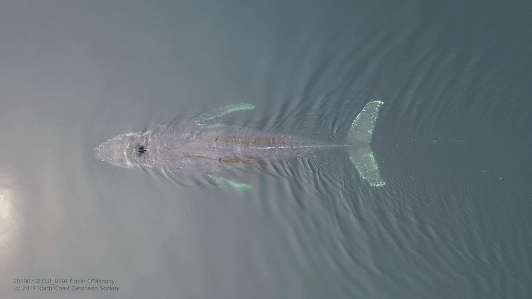
Photo by Éadin O’Mahony | © North Coast Cetacean Society
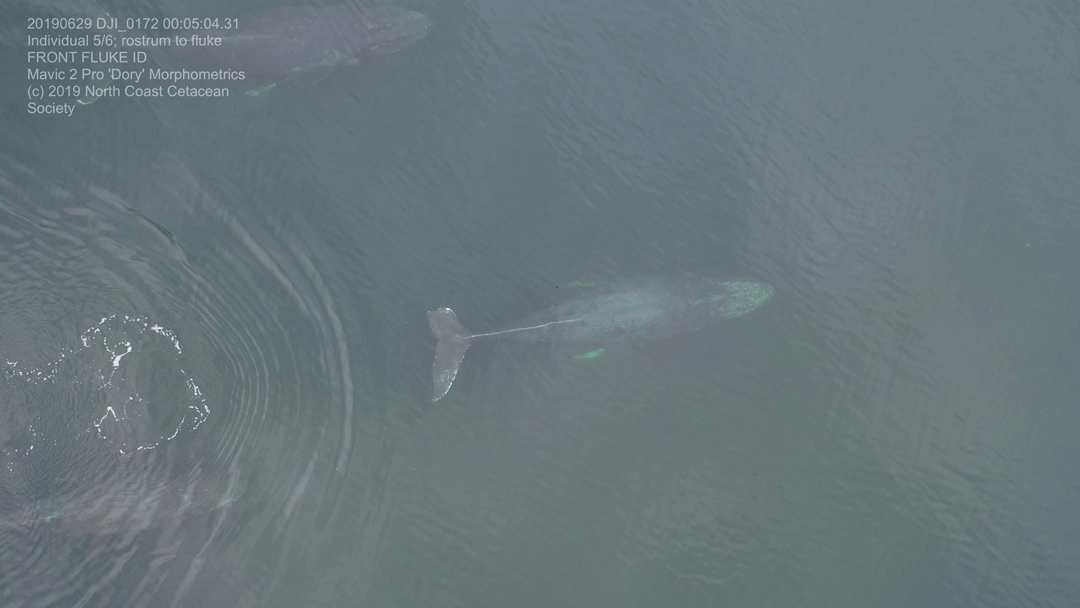
Another blow, a huge back arching and rolling, slowly revealing to us her identity – as her tail fluke clears the water into view we recognise Coste. The drone is in position, hovering 20 metres above the sea, filming everything it sees in stunning 4k quality. Textbook bubble-net feeding calls ring out over the hydrophone network1, except what’s not all that textbook about it is that this whale is bubble net feeding on her own – multi-tasking the calling, the bubble-net blowing and the lunging feed through the centre of the net, trapping a shoal of fish within. As soon as she surfaces, I bring the drone directly above her with my camera pointed straight down.
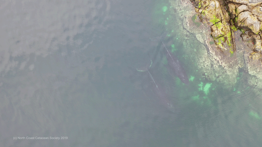
Humpback whales close to shore. Photo by Éadin O’Mahony | © North Coast Cetacean Society
The drone is equipped with specialized technology, including a high-grade GPS device and LiDAR laser, which emits a regular laser pulse and records the length of time it takes for this laser pulse to bounce off a surface and come back into the LiDAR device. This laser kit allows us to know the exact height of the drone above the sea surface, and in combination with footage of the whales from directly above, means we can calculate the size of each individual, both in length and width.
With an astonishing level of understanding of these whale populations due to the ongoing dedication of the BC Whales’ research team, this birds-eye view is providing a whole new level of insight into their behaviour, their nutritional status (and thus their recovery from a long fast on the breeding grounds); pregnancy rates within the population; calf size in relation to its mother; as well as injury, scarring and entanglement frequency amongst these gentle whales.

Fin whales. Photo by Éadin O’Mahony | © North Coast Cetacean Society
As soon as I have the necessary footage, I bring the drone back to land. Although this research method shows no behavioural response from the whales and has been stringently tested for its level of “non-invasiveness”, I still aim to spend as little time as possible near the whales with the drone. Thereby we can collect vital data, continuing to deepen our understanding of this population, but preserving the sounds of nature in these remote fjords by minimizing excessive mechanical noise as much as possible.
 And so, by 06:30 in the morning, we already have collected novel information on another member of the whale populations (including not just humpback whales but also fin whales and orca), that are foraging in the fjord-system of the Great Bear Rainforest, northern British Columbia, Canada. By my standards, I would say a spectacular start to any day!
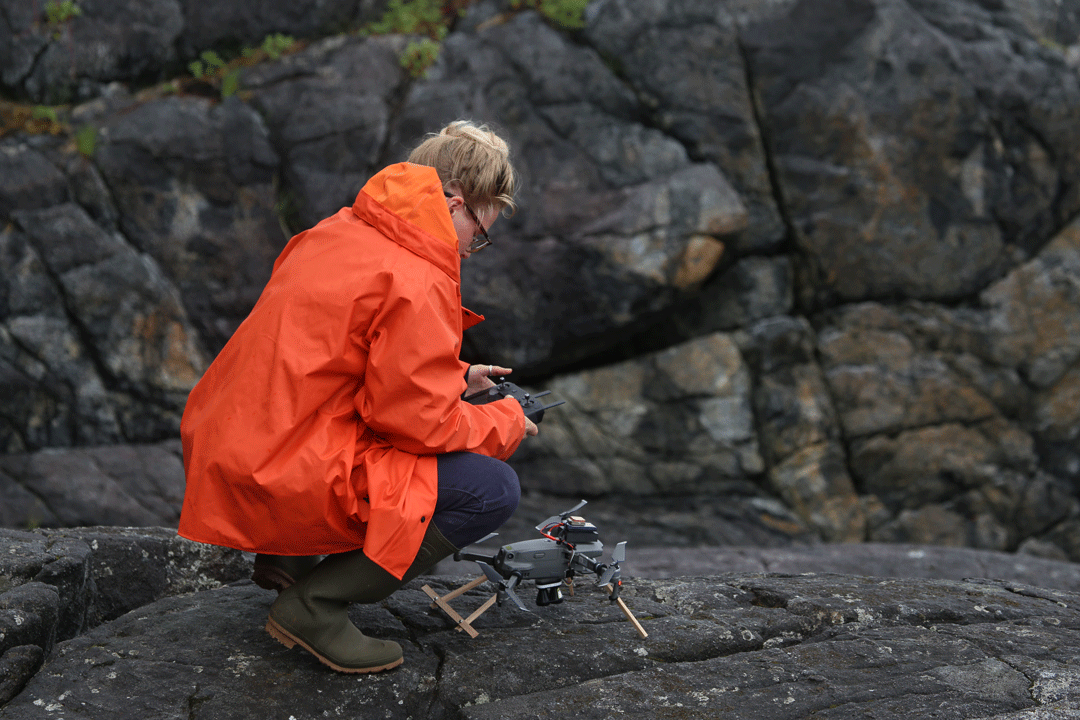
Drone pilot Éadin O’Mahony. Photo © North Coast Cetacean Society