Up Close
As research scientist curiosity has bring me to explore new fields and species. Eagle rays are one of those species very unknown for me and also for people inhabiting the coast of Atacama Desert in the South East Pacific (northern Chile). The first time I saw them I was on a marine wildlife-watching trip and I saw a huge shadow down of the boat that flew away from us in just one second! Who was that animal so shy and elusive? Later when I got my first drone I thought that maybe by flying the drone above them we could observe their behaviour without disturbing them.. and bingo! In the first flight and in just one minute I was able to observe two Chilean eagle rays (Myliobatis chilensis) resting in the coastal sandy bottom of Playa Grande in Mejillones Bay. Hence I decided that we should start a research on Chilean eagle rays using drones.
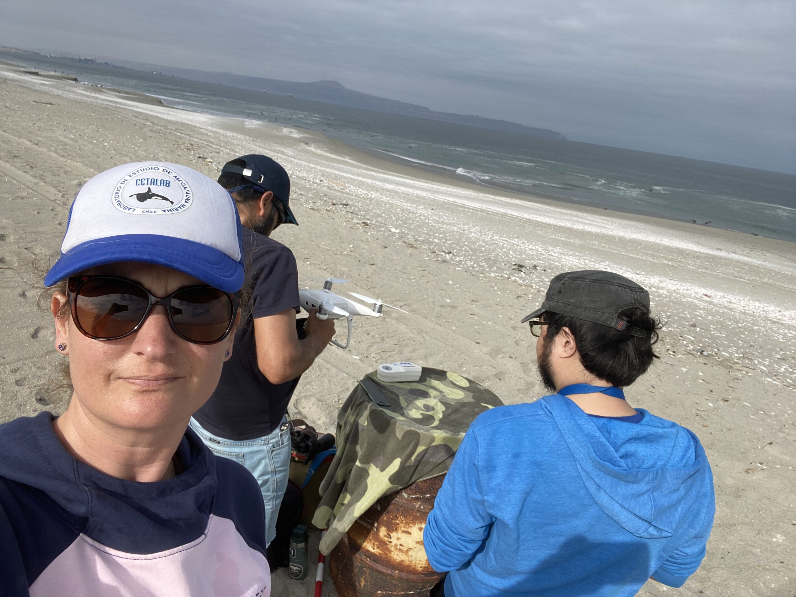
CETALAB Team starting one day of drone flights to observe chilean eagle rays (Myliobatis chilensis) presence. Photo © Ana García
Save Our Seas support
It has been now more than 6 months since we started our project to investigate the density, distribution and habitat use of Chilean eagle rays in the coastal waters of Atacama Desert and we have had incredible moments with these enigmatic animals.
During the winter we were afraid that the strong El Niño event we are having in 2023 will increase the presence of eagle rays in the coast due to the increased water temperature. However to our surprise we did not observe any eagle rays during austral winter in coastal sandy beaches. But with the arrival of summer the conditions changed and in December we have had the most amazing encounters with these animals. We have been able to fly the drone and observe them very close to shore in crystal clear waters. So we decided that the conditions were ideal to try to snorkel with them and obtain underwater images.
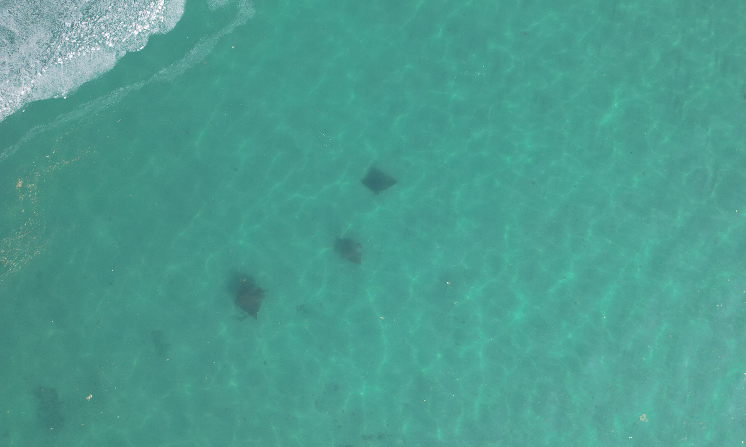
Drone image of three Chilean eagle rays swimming in crystal clear waters of Mejillones Bay. Photo © Enrique Bejarano
Green waters…
However, the strong primary productivity of the Humboldt Current System and specially in Mejillones where we have one of the most intense upwelling cells made it difficult for us to obtain good quality underwater images. We used a stick meter in order to be able to measure them with the use of the drone. Stay tuned for future blog updates to see the measurement technique!
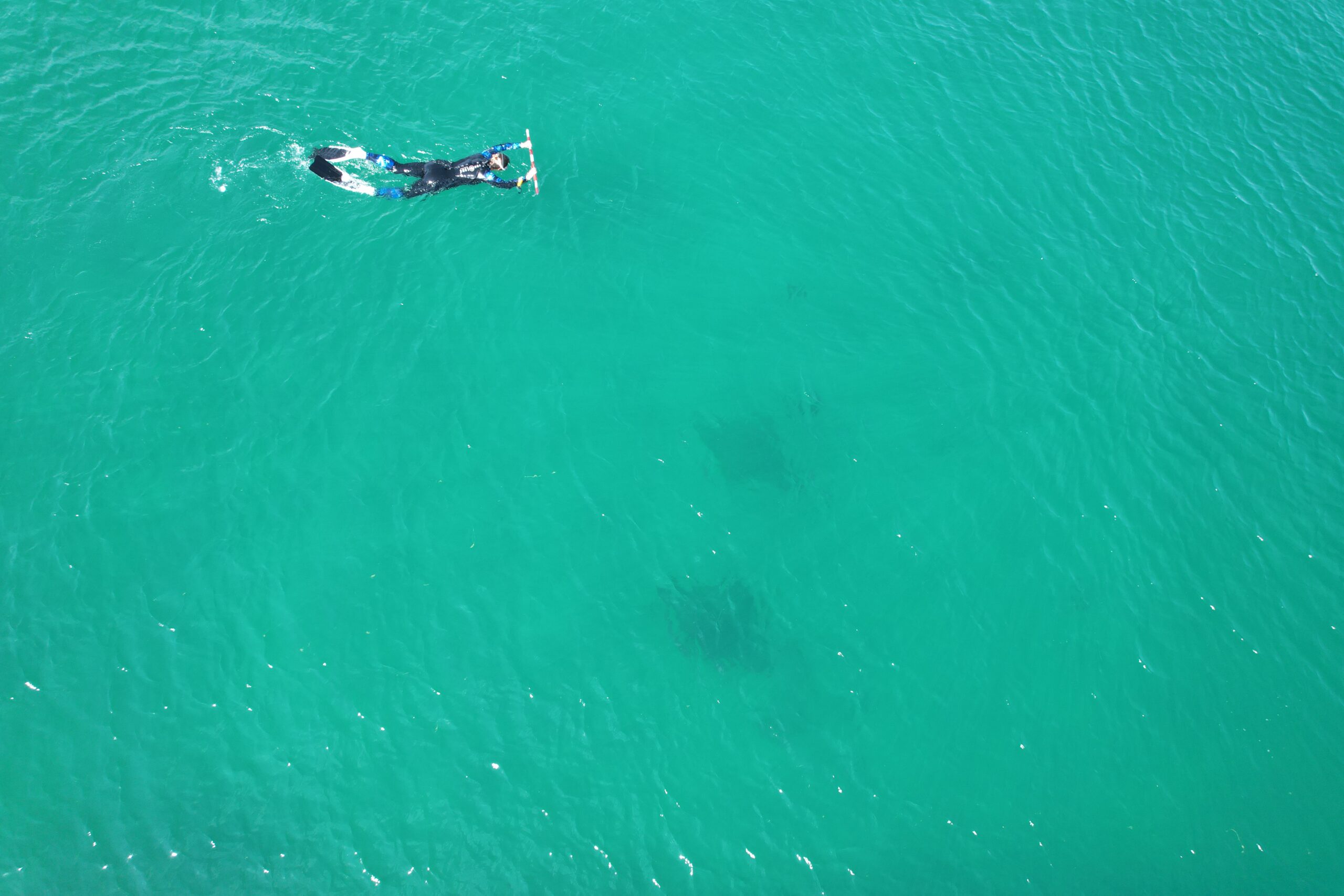
Drone image of me during snorkeling nearby two adult eagle rays. Photo © Luis Aguilar